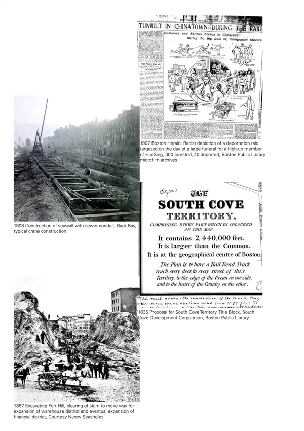
An on-going project with the Chinatown Atlas to witness larger transitions in the built, cultural, and economic landscape of the South Cove, and Boston, since colonial settlement, through the detailed description of the history of a single site. (The site, 72 Kneeland, being the building in which I myself lived.)
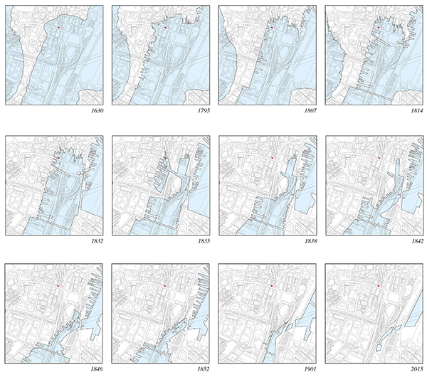
[fig.1] Mapping incremental land-fill and wharfing projects in the South Cove
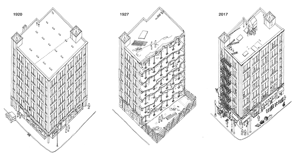
[fig.2] Axon of building at 72 Kneeland across time, including the moment of being cut in half
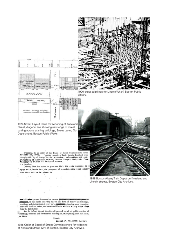
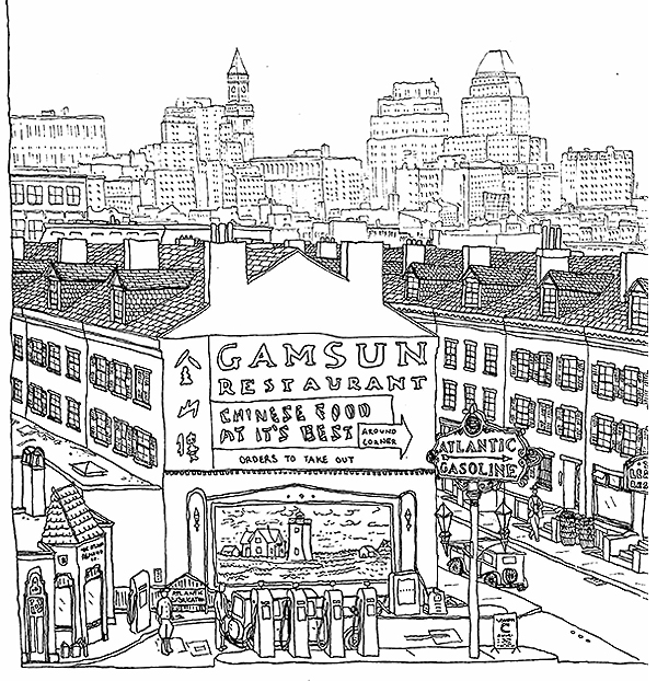
[fig.3] Reconstructed drawing of neighboring parcel to 72 Kneeland after the widening of Kneeland in 1927 which resulted in the demolition of buildings and small gas stations on the remnant half lots to service the expanded car traffic.
Drawings and research summary will be soon available within a book on the geographic and built history of Bostons' Chinatown produced by the Chinatown Atlas and published by MIT Press.
>> What Happened in the Place in Which I Lived? - Sarmad
Magazine Book #5, Home
>> DRAFT of book page spreads
>> DRAFT website page